Published on Monday, 31 August 2020 at 12:01:36 PM
AEM surveys are widely used for groundwater mapping, as well as for mineral and energy resources exploration. This survey will provide regional data coverage for more informed natural resource management and better focussed exploration investment. The survey is funded via the Western Australian Government’s Exploration Incentive Scheme.
AEM survey method
Aircraft fitted with electromagnetic instruments map variations in the electrical conductivity of the ground to a depth of several hundred metres without any ground disturbance.
What you may see
A Helicopter, towing equipment below it, will make a single pass approximately 100 m above the ground, along tracks 20 km apart (see Figure 1 on reverse side of this notice). If you have any concerns with this activity, please make further enquiries via one of the contacts listed below.
Important to know
All data produced by Geoscience Australia and GSWA from this survey will be freely available after quality assurance checks have been performed.
Timeframes and work area
The survey will be flown from late September to December 2020. Figure 1, on the reverse side of this notice shows the location of the survey. The area covers the Southwest of Western Australia including Esperance, Norseman, Bunbury, Albany and Corrigin. While the survey also includes the perimeters of Perth City, it will not cover urban areas.
Covid 19 Protocols
Geoscience Australia and Geological Survey of Western Australia are committed to maintaining a healthy and safe workplace. Our commitment to a consistent national approach includes clear and transparent communication, forming best practices in prevention, mitigation, and response to the risks presented by COVID 19. We ensure our contractors have: adequate cleaning solutions when using equipment, access to handwashing facilities, personal protective equipment and observe social distancing where possible. The survey will be conducted in accordance with relevant state and national restrictions regarding Covid-19. Staff or contractors will not enter any remote Aboriginal Communities. No ground disturbance will occur within the survey area.
For further information Geoscience Australia Email: clientservices@ga.gov.au Phone: +61 (0)2 6249 9111 Mobile (Survey Hotline): 0427 192 745 www.ga.gov.au Department of Mines, Industry Regulation and Safety Email: geophysics@dmirs.wa.gov.au Phone: +61 (0)8 9222 3331 www.dmirs.wa.gov.au/geophysics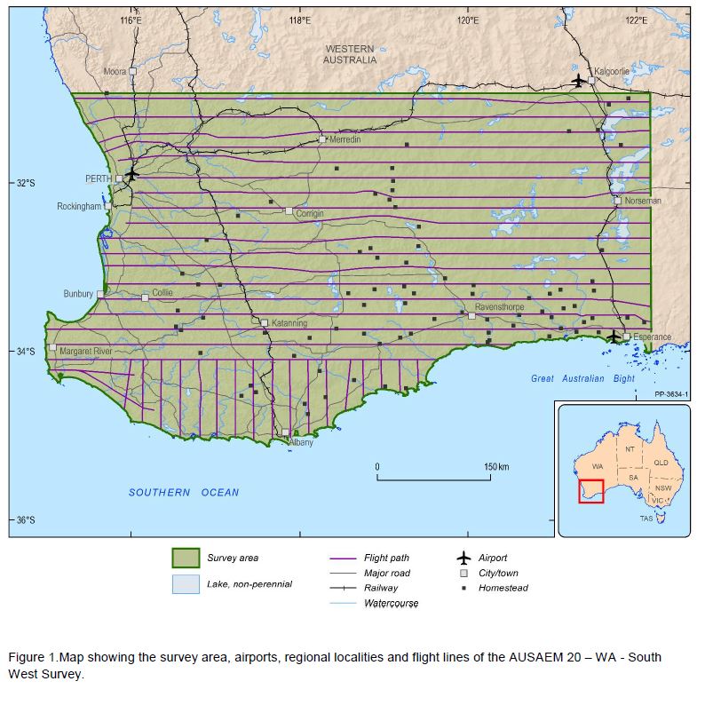
Back to All News